Edit Track
MapOnMap also supports Track Editing.
Some times it is useful to be able to change existing tracks.
You might want to start at one track but want to continue on a crossing track etc.
Therefore, MapOnMap has a number of editing features available.
Merge crossing tracks
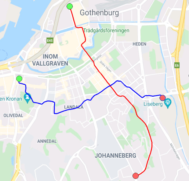
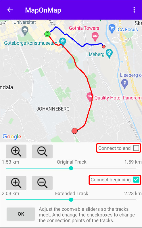
In this example we have two tracks.
The first between the two points, North and South and the second between West and East.
First track north to south marked in red.
Second track west to east marked in blue.
Let's make a new track that combines the northern and western points.
- Select "Extend with track file" from the menu.
- You must now open a second track.
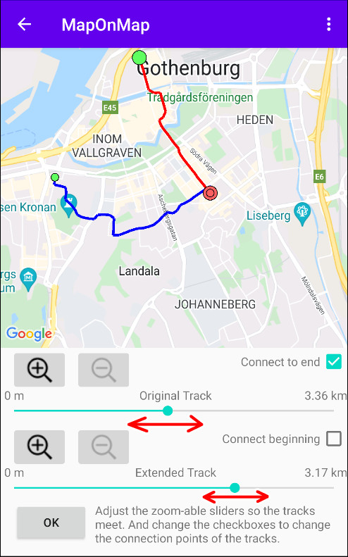
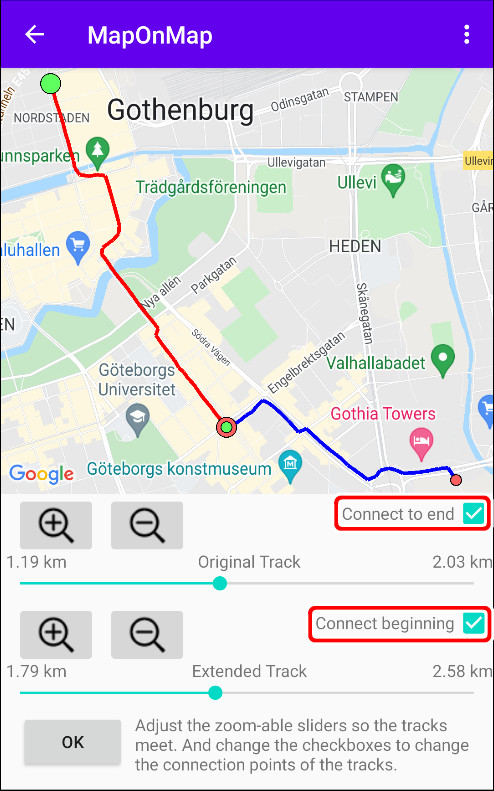
- Make sure the "Original Track - Connect to end" and "Extended Track - Connect beginning" checkboxes are ticked.
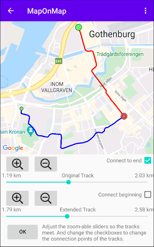
- Make a rough adjustment with the sliders so the tracks meets in the crossing point.
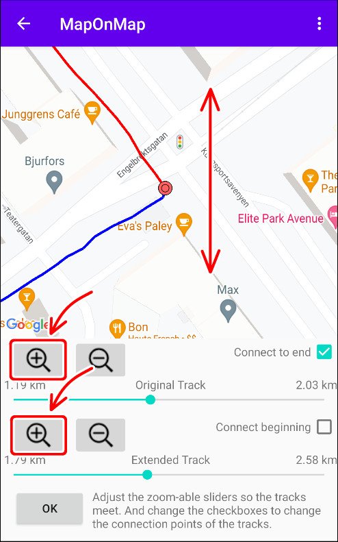
- Zoom in map and sliders so a fine adjustment can be made.
1. Rough adjustment.
2. Zoom in map and sliders to make a fine adjustment.
3. Track between northern and western points.
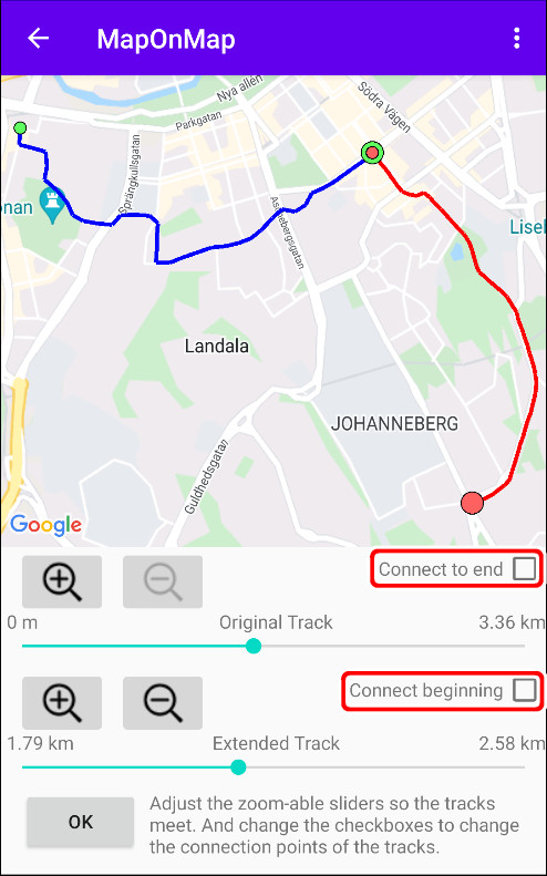
If you instead want to make a connection between any of the other points, you do that by changing connection check boxes.
The connection check boxes decides which track ends will be used.
Extend track with track
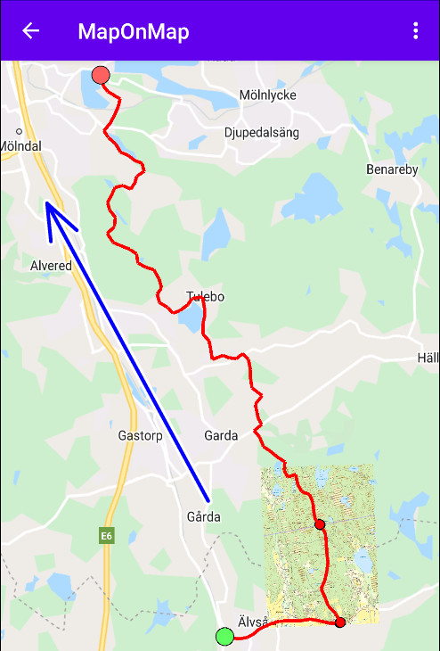
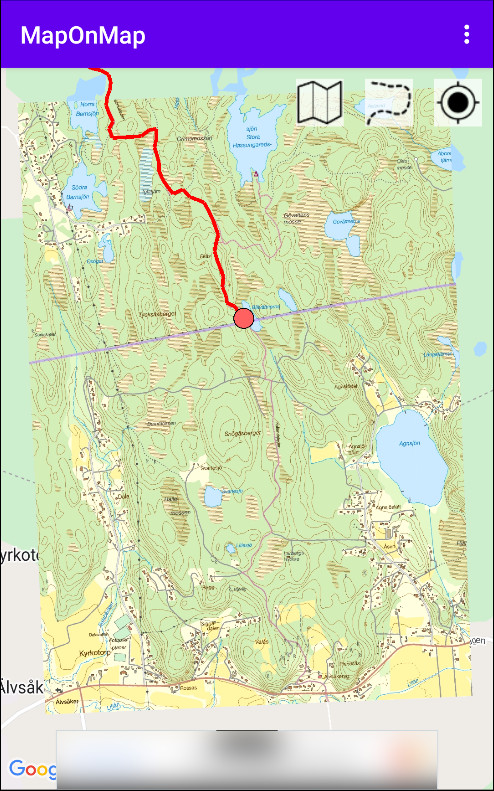
In the next example, I have a track that has one of its ends in the middle of the forest.
So I want to connect a continuing track to it.
- Select "Extend with track file" from the menu.
- You will now need to open a second track.
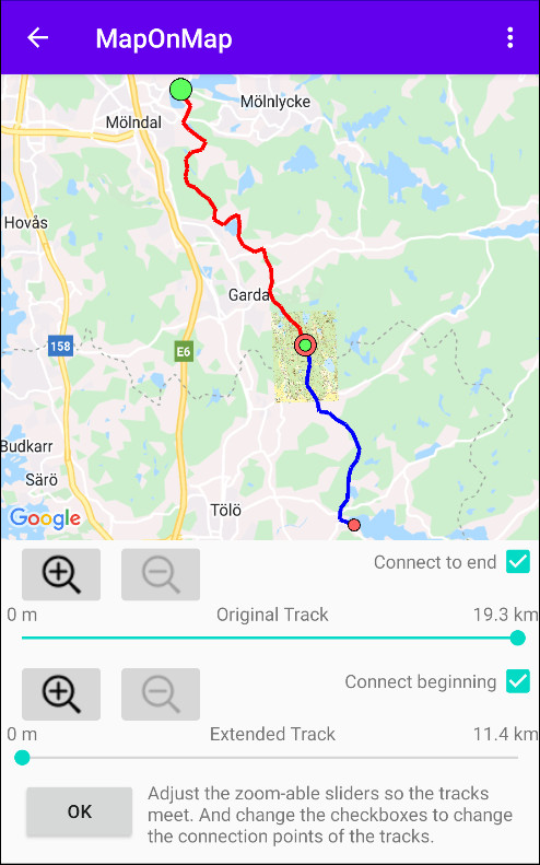
- In this case, since it is not a crossing track but an extension.
The correct connection boxes should already be selected.
So the tracks meet at the shortest distance between their endpoints.
You may zoom in the map to make sure that there is no overlap.
To the left, the track that ends in the middle of the forest.
And to the right, how the second track connects.
Cut track
Lets continue with the example from above.
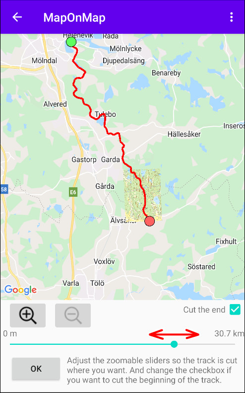
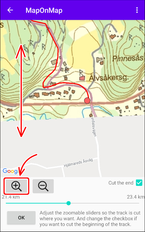
Since I did not want to go all the way on the second track, I therefore want to cut it where it meets the road.
- Select "Cut Track" from the menu.
- Make a rough adjustment with the slider.
- Zoom in the map and the slider so you can make a fine adjustment.
1. Rough adjustment.
2. Zoom in map and slider to make a fine adjustment.
Extend track manually
In the example above the track now ends in the crossing road.
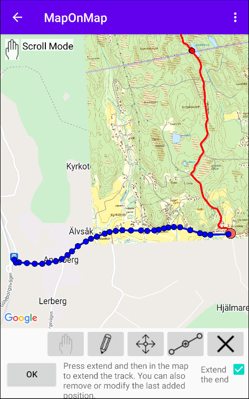
But I need to extend it to the train station, since that's the closest stop for transportation.
- Select "Extend manually" from the menu.
- Zoom in the map near the track ending you want to extend.
- Make sure the correct value in the connection check box.
- You can now extend the track by clicking the extend button and then in the map where you want the new point.
|
|
|
Scroll mode
In this mode you can scroll and zoom freely without risking of making any unintended changes.
|
|
|
|
Draw mode
In this mode you can add track points.
|
|
|
|
Modification mode
In this mode you can modify track points.
|
|
|
|
Insert mode
In this mode you can insert new track points.
|
|
|
|
Remove mode
In this mode you can remove track points.
|
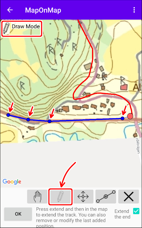
1. Extend point by point.
2. The extended track to the train station.
Toggle track direction
Continuation from previous example.
Now I have a track that start in the north and ends at the train station at the south.
But since I wanted to start at the train station I have to change the direction.
I do that by selecting "Toggle direction" in the menu.
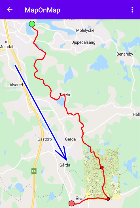
The green dot marks the beginning and red one marks the end.
Edit segments
A GPX Track is built up by one or several segments.
So there is therefore an edit mode to manipulate with the track segments.
|
|
|
Remove
This buttons removes the selected segment.
|
|
|
|
Split
With this you can split up the selected segment.
You will get a slider so you can select where you want to cut.
|
|
|
|
Merge
This will merge the selected segment with the merge candidate (the next segment in the list).
Please make sure that the segments facing the same direction before merging.
|
|
|
|
Toggle direction
This toggles the direction of the selected segment.
|
|
|
|
Move segment
With this you can move the segment in the segment list.
I.e. changing the index of the selected segment.
|
|
|
|
Select segment
With this select segment by going up or down in the segment list.
Please note that you can also select segment by taping on it in the map view.
|
|